Thursday, February 24, 2011

Mount Sinai Summit Loop, Sinai Peninsula, Egypt


Distance: 5 miles (8 km)
Elevation: 5150 - 7497 feet (1570 - 2285 m)
Difficulty: Strenuous
Season: September - May


From Saint Catherines Monastery, you are looking up at the famous Mount Sinai, also known in Egypt as Jebel Musa (Mountain of Moses). It is the 2nd highest peak in Egypt (7,497 feet), about 1,100 feet lower than the adjacent 8,600 foot Mount Catherine. For the few of you who don't know the most basic details of the bible, Mount Sinai was the place Moses supposedly recieved the tablet with the Ten Commandments. However, most biblical scholars now believe it actually happened on a different mountain, perhaps over in nearby Saudi Arabia.


For reasons that were unclear, we were not allowed to just go up and hike to the summit on our own; we had to be led by a local guide. But, the trail to the summit is quite obvious and there is not real chance to get lost. I suspect it was just to help support the local economy with tip money. The hike from the monastery to the summit takes about 2.5 hours along the gentle contours of the camel trail. Websites claim you can also hire a camel for the trek. We didn't see that option, but we also apparently were not there during the peak season. 

At the first pass before beginning the main ascent, there is a great view of the next valley

I read that most people either leave at 3am to catch the sunrise or 3pm to catch the sunset. One of the reasons is that it is too hot in the middle of the day, especially in summer. But, we left around 8am and had no problems, especially since it was December and pretty cool outside. Personally, I am glad we did it in the day because then I was able to see and photgraph the entire route, rather than doing half of it in the dark.

Looking up at the mountain you still must climb

The climb is moderately strenuous for the first 70% of the way and then become strenuous in the final 1000 foot approach to the summit. That last part was a killer.

Looking back into the valley from near the summit

Prior to coming here, I just assumed I'd see something ecologically similar to what we see in the deserts of North America; that the higher we got the more vegetation there would be. But, that was not the case at all. There was no vegetation anywhere...just barren brown granitic rock. I guess when you get only 1" of rain per year, increasing elevation for condensation does not matter if there are no clouds. Even for the rain that does fall, with humidity levels under 10%, it doesn't last long before evaporating away.


Upon reaching the summit, there is a spectacular panorama of starkly barren mountains and the Red Sea faintly visible on the distant horizon. At the summit is also a small Greek Orthodox Church and a small mosque. It is cool up there, especially in winter and even more so if there is a breeze.


After enjoying the view, it was time to head down the steep-side containing 3700 rocky steps called the "Steps of Repetence". About a 1000 feet down you come into a small basin containing a water containment wall, which supports about the only plants we saw anywhere, including some grass and a few 500-year old cypress trees. This wall was built hundreds of years ago to protect the monastery from flood damage. This Elijiah's Basin, where the 70 wise men apparently waited for Moses, while he went to the top to get the Ten Commandments.

Elijiah's Basin below

After leaving the basin, you enter a narrow slot canyon with a very steep drop. Soon you will see that way down below you is Saint Catherines Monastery and you are thinking, I am going down there?


But, yes, you will make it and when you are done you can sit down to enjoy some nice Bedouin tea and it will be all the worth it to see such a spectacular site of geologic and cultural significance.

Saint Catherines Monastery way below

Sunday, February 20, 2011

A Redesigned 50 Hikes of Tuscany Website

Dear Friends,

My old website www.50hikesintucany.com expired recently and I was not willing to spend the exorbitant amount GoDaddy was asking to keep it online. Thus, I decided it was time to migrate it over to blogger.com. I also decided it was a great chance to redesign the website and improve it. I have now included many never-before-seen pictures of the different regions of Tuscany and vicinity in an easier to read layout. I hope all of you will take a few minutes to head over to the new website in the Hikemaster's series and check out each of the links on top to see the changes. Thanks for your support on this blog!

http://www.50hikesoftuscany.com/


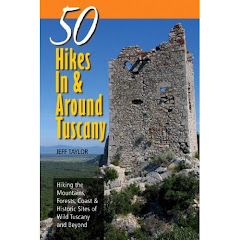
50 Hikes In and Around Tuscany

Hiking the Mountains, Forests, Coast, and Historic Sites of Wild Tuscany and Beyond


With Assistance by Linda Lenz and Maile

Published by Countryman Press


From high mountain meadows to rocky coastal cliffs, dense chestnut forests to abandoned medieval villages, Tuscany is a land of stark contrasts, fascinating history, and spectacular hiking opportunities.


50 Hikes In and Around Tuscany is the first comprehensive hiking guide to this incredible landscape that offers visitors the opportunity to explore the "wild" Tuscany, no one hears about.


On this website you'll have the opportunity to see photographs of from all 50+ hikes in this book and I sincerely hope this will inspire you to get off the beaten track to explore this incredible slice of Italy.


Above you can see all of the regions covered in the book, including basic hike descriptions and introductory notes on the ecosystems, geology, and cultural history of each region.


For reviews, questions, or comments, please email me at hikemasters@xwb.com


For detailed hike descriptions of other hikes we have done outside of Tuscany, check out the Hikemaster's Trail Description Site at www.hikemasters.com/

Wednesday, February 16, 2011

Cow Pies and Mitten Ridge, Sedona Red Rock Country, Arizona


Distance: About 5 miles (8 km)
Elevation: 5046 - 5202 feet (1538 - 1586 m)
Difficulty: Moderately Easy
Time of Year: Any Time

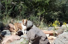
Hilina and Sophie on the Cow Pies

Located up the Schnelby Hill Road, just east of Sedona, is a really interesting area of slick rock platforms and high cliffs called The Cow Pies. The Cow Pies are three rounded platforms with concentric rings that superficially look like cow pies from the air. They are also supposedly one of the "vortex centers" of Sedona. So, it is likely you will see rocks lined up on the platforms by folks to represent various things. But, in addition to the interesting features and spectacular views, this hike also has a wonderful surprise over on the saddle of Mitten Ridge you have to check out.


To get to the trailhead, head on Hwy 179 south from Uptown Sedona and at the traffic circle directly south of the Oak Creek Bridge, turn up Schnebly Hill Road. Follow the road up until it turns into dirt. Then, follow it up 3.6 miles of rough going to the trail with a small sign saying "Cow Pies" on the left and a large rock platform parking area. I do not recommend trying to get up onto that platform, unless you want to scrape bottom; but rather park on the roadside.

A dried up vernal pool

The trail heads about 1/2 miles through Arizona cypress and juniper until arriving at an open slick-rock area. There, the routes split with straight ahead going to Mitten Ridge and the left turn out to the Cow Pies. There will be rock cairns to show the way. First head out to the Cow Pies. There are three of them and the most spectacular view is from the last one.

View from the last Cow Pie

These Cow Pies are covered with depressions which fill with water after rains. They look just like the type to contain tiny crustaceans that live efemerally in seasonal pools. I would love to go back after the monsoon rains in August and see what hatches in the pools.

Almost to the saddle with spectacular views awaiting

Now, backtrack and look for the way-trail heading up to the edge of Mitten Ridge. Here you will see a trail heading along the side of the cliff-face out toward the saddle on the western-side of the ridge. The initial access to this trail is a bit dicey, as it goes along the edge of a ravine, but then levels out and is quite safe after a hundred feet or so.

Approaching the top of the saddle and the views are appearing

As you follow the Mitten Ridge route, the trail will follow several slick rock platforms and then comes up to the edge of the saddle. This last section is the trickiest as you must ascend the last 50 feet or so up steep rock. There is a trail in the bushes at the right edge of the steep rock and is much easier than trying to scramble up on all fours. Once at the saddle, there is a spectacular view down to Oak Creek Canyon and the entire Sedona Red Rock Country!

Wow, look at Oak Creek Canyon below

Be aware that Mitten Ridge is apparently popular with mountain bikers. I ended up walking this as quickly as they cycled it and even beat two cyclers who passed me earlier to the top of the saddle, because it is really technical stuff for them. There is a little trail that goes down the otherside and I overheard a bike rider saying it goes all the way to the bottom of the canyon.


Just backtrack the way you came and the trail will quickly take you back to your vehicle.


Saturday, February 12, 2011

Soldiers Pass-Brins Mesa Loop, Sedona Red Rocks Country, AZ


Distance: 5.5 miles (8.9 km)
Elevation: 4600-5450 feet (1400 -1660 m)
Difficulty: Moderate
Time of Year: September to June


Located in the spectacular Red Rocks Country of the Coconino National Forest adjacent to Sedona is an excellent loop hike that gives a great introduction to the area. This hike offers folks the chance to walk up a beautiful valley filled with Arizona cypress up to a saddle between two towering cliffs of red rock for panoramic views across the entire area. After traversing the mesa, you descend into another beautiful valley, hike around one of the mountains, and then return on the otherside, completing a loop. To access the trailhead, drive into West Sedona on Hwy 89A. Turn on Soldiers Pass Road and follow it almost to the end and then turn right onto Rim Shadows Road (there is a sign for Soldier's Pass there). At the bottom of the hill turn left into the gravel parking area. You will need a Red Rock Pass to park here.


The trail begins by first traversing a small ravine and then heading up the valley through a forest stand of Arizona cypress, pinyon pine, and juniper. Throughout this open stand there are numerous views of the spectacular red rock cliffs that rise on either side of the valley. After passing the Jordan Trail on your right (your return route), the trail will arrive at the first site to see. This is Devil's Kitchen, a deep sinkhole that is the result of a collapsed cavern.


As the trail continues, the next significant site will be the beautiful "Seven Pools". Here, the creek bed drops into a ravine, but not before leaving seven beautiful little plunge pools which are usually full of water. The trail then continues up to Soldier's Pass gradually until the 1.5 mile mark, where it will begin to ascend more steeply. As you ascend, look to your right to see two arches on the cliff walls.


At the top of Soldier's Pass, look for a way-trail leading off to the right where it will end at a cliff offering spectacular views back down Soldier's Creek Valley into Sedona. This is a great place to eat lunch. You are standing on Brins Mesa and panoramic views abound. You can see to the north and west toward Boynton Canyon and the Mogollon Rim. If you choose to turn around here, it'll be a 4.5 mile roundtrip. But, if you continue around, even more interesting sites await.


Continue on the trail until arriving at the junction of Brins Mesa Trail. Turn right and follow it across the mesa through a burned area, and to the edge of another cliff. Here, you can look down into Mormon Canyon, Uptown Sedona, and can see Schnebly Hill and Mitten Ridge in the distance to the east. The trail will descend down steeply into the valley.


The trail will continue until arriving at a parking area at the end of West End Ridge Drive. Just before arriving at the cars, look to the right for Cibola Pass Trail. Follow this trail back upslope. It will ascend briefly until arriving at Cibola Pass, where you can look back down toward where you started. Follow the trail down the otherside until arriving at the junction with Jordan Trail and turn right. This trail will connect you back up with Soldier's Pass Trail shortly and you will be done.

Just Giving Back For All To Enjoy

Why pay money to buy hiking books? Why pay fees to view trail websites? By searching my archives and checking back often to see new posts, we are sure you will be able to find the hike that is right for you ... and for free!

In addition, we provide fascinating ecological and geological information to make the hikes informative and fun. As former National Park Rangers, we know how to find the right hike for you. So, if you are on vacation, we will provide you with the hike you absolutely MUST do while in an area. Do not go on vacation without checking out this site!