Friday, November 11, 2011

West Fork Oak Creek Canyon, Coconino NF, Arizona


Distance: 6.0 miles (10 km)
Elevation: 6,000 feet
Difficulty: Easy
Time of Year: Anytime, but October is best!


When people think of fall colors, they usually think of New England, or the Appalachians, or Wisconsin. But, rarely do people say Arizona. But, there is one place in the Desert Southwest where the fall colors rival anything in the east...The West Fork of Oak Creek Canyon. Located a few miles north of Sedona, at 6,000 feet in elevation, the high walls of the canyon provide critical shade for a myriad of species that could not ordinarily survive in the region. The year round flow of water in the creek also provides the necessary moisture to support riparian deciduous trees like ash, alder, Arizona walnut, box elder, gambel oaks, and most significantly canyon maples.


The West Fork of Oak Creek Canyon is very popular, especially during its peak colors in mid-to-late October. So, get there early and be prepared for crowds (especially along the first mile). The site is run by a concessionaire authorized by the U.S. Forest Service. Parking in the lot costs $8, and they charge $2 per person if you park outside the lot and walk in. But, it is worth the cost.


To get to the site, drive up AZ-89A from Sedona about 10 miles. Look for the lot to the left, which will be hard to miss since there will probably be cars lining the highway with people trying to save a buck. You can also access it from Flagstaff by driving AZ-89A down just a couple of miles below the switchbacks.

Red and white cliffs rise above white firs, alder, and canyon maples

The trail begins by crossing an old apple orchard and some old farmhouses. Once it enters the canyon proper, red-orange cliffs rise over 1000 feet above the canyon floor. The vegetation is remarkable for this arid ecosystem. In addition to the previously-stated deciduous trees, there are a number of conifers that typically occur at higher elevations including Ponderosa pines, Douglas firs, and white firs.

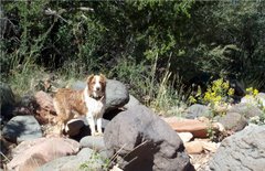
Sophie turned orange by the dappled light through the canyon maples

The trail leisurely follows the canyon bottom, crossing the creek several times, with amazing views all along the way. At the creek crossings, rocks strategically piled up make the crossings pretty easy, unless heavy rains raise the water levels. At no stage is it difficult, but you will definitely see the crowds thin the further you go. Most of the people linger in the first mile.

We tried to tell Hilina that maple syrup is in the bark, not the leaves! :)

As the trail nears its established end, it rises up a slope into an upland forest, before descending to a narrow section of canyon where the water covers the entire section. This is the end of the established trail at 3 miles. However, if you are adventurous, have wading gear, and are prepared to swim across a few pools, then you can continue hiking up the canyon for many miles more. Camping is not allowed until you are at least 6 miles up. But, the canyon itself continues for 14 miles until reaching the top of the Mogollon Rim.


Sunday, November 6, 2011

Inner Basin of the San Francisco Peaks, Coconino NF, Arizona

It has been a long time since I've written up one of these. We have been so busy since moving to Flagstaff with our new jobs that we simply have not had the time to write up much. But, with the first snowstorm having hit Flagstaff, it reminded me that I ought to publish something regarding the hikes in the area.


Distance: 5.2 miles roundtrip
Elevation: 8,000-10,000 feet
Difficulty: Moderately Easy
Time of Year: May-October (snowshoeing of cross-country skiing in winter)


The San Francisco Peaks are actually the remains of a large stratovolcano that had a catastrophic eruption approximately 6 million years ago that very much resembled Mount St. Helens. Originally more than 15,000 feet high, today "The Peaks" stand at 12,700 feet in elevation, marking the highest point in Arizona. It was a lateral blast toward the east that blew out a huge crater and approximately 3,000 feet off the top of the volcano. The Inner Basin today represents the remains of that huge crater that formed. The Inner Basin Trail takes you into the heart of an ancient volcano, as it also climbs through spruce/fir forests, aspen stands, and into beautiful grassy meadows in its heart with panoramic views of the peaks and out across to the Painted Desert to the east.


To access the Inner Basin Trail, drive just a few miles north of Flagstaff on US-89. At the turnoff to Sunset Crater National Monument to the right, turn left instead and follow the forest service road. This dirt road will take you to Lockett Meadow, an old campground that was closed following the catastrophic Schultz Fire of 2010, but is the trailhead for the Inner Basin Trail.

Mixed conifer/aspen forest in the Inner Basin

There are two ways up into the Inner Basin, which allows you to make this trail a loop. To the right is a gated old road that is the driving access for the City of Flagstaff to access the pumping stations, as the Inner Basin is a collection site for the municipal water supply of the city. Start off by following this old road (since most of the people take the trail). All along this dirt track are beautiful stands of aspen, intermixed with subalpine firs, Engelmann spruce, Southwestern white pine, and Ponderosa pines. In late September and early October, the forest is alive with brilliant yellows and oranges.


Avalanche Chutes on Fremont Peak

About 2 miles up the road, you arrive at the first of the pumping stations and rejoin the "official" Inner Basin trail. From here, it is only an additional 0.3 miles to the meadows of the Inner Basin. Once you arrive in the meadows, the views open up to the walls of the caldera. The highest of the San Francisco Peaks is Humphrey's Peak to the right. It is 12,637 feet high. Straight ahead to the due west is 12,356 foot Agassiz Peak with its avalanche chutes and the Weatherford Trail cutting across its side. To the left of that is Fremont Peak and then further left is Doyle Peak.


Inner Basin Meadow with views of Humphrey's Peak (right) and Agassiz Peak (left)

Once in the Inner Basin Meadows, you will find your first Bristlecone Pines. These pines do not grow below 9,500 feet in elevation and can be quite ancient. Some of the ones higher up on the sides of the peaks may be well over 1,000 years old.

12, 637 foot Humphrey's Peak - The highest point in Arizona

This is the turn around spot for most people. But, if you continue to the back of the basin, the trail will start to ascend up toward Fremont Peak where it will meet up with the Weatherford Trail at Doyle Saddle. Here, you can either cut across Agassiz Peak to Humphrey's Saddle and then an ascent to the summit; or you can descend down the otherside and out of the basin.

View out of the Inner Basin toward the Painted Desert

But, as you turn back to return to Lockett Meadow, you get a great view off to the east into the Painted Desert beyond. Once you return to the pumping station, turn right and follow the "official" trail back through never-ending stands of large aspens that grew up about 130 years ago after a major fire went up the basin.


What a great trip in fall to see the colors. But, it really can be done any time of year if you are prepared (snowshoes or cross-country gear) in winter. In July and August, just get an early start and be prepared to get wet in afternoon monsoon thunderstorms. But, in June or September/October, the skies should be sunny!

Just Giving Back For All To Enjoy

Why pay money to buy hiking books? Why pay fees to view trail websites? By searching my archives and checking back often to see new posts, we are sure you will be able to find the hike that is right for you ... and for free!

In addition, we provide fascinating ecological and geological information to make the hikes informative and fun. As former National Park Rangers, we know how to find the right hike for you. So, if you are on vacation, we will provide you with the hike you absolutely MUST do while in an area. Do not go on vacation without checking out this site!