Distance: 6 - 8+ miles
Elevation: 6834 - 6590 feet
Difficulty: Easy
Time of Year: Anytime (watch for ice and snow in winter)
Located just a stone's throw from Flagstaff, Arizona is a hidden gem to explore. While many people who travel through the area may be aware of the amazing cliff dwellings within Walnut Canyon National Monument about 5 miles east of Flagstaff, most people probably do not realize that they can hike into the spectacular canyon just a few miles upstream.
The trail can be accessed by driving down Lake Mary Road abput 5 miles south of Downtown Flagstaff (near the intersection of I-40 and I-17) toward Mormon Lake. Before reaching Lake Mary, look for the Canyon View Campground on your left. Park just outside of the campground and a trail will leave toward the canyon rim. To the right, an access trail heads down to the cliffs where rock climbers hone their skill. Stay left and the trail will take you down into the upper reaches of Walnut Canyon in a side-canyon called "Sandy's Canyon"
 |
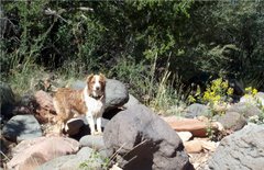
| Hilina pounding out the resprouting grasses after a prescribed burn |
Prior to the building of the dam on Lake Mary to contain the waters that make up 50% of Flagstaff's water supply, Walnut Canyon actually contained a free-flowing creek that sustained the ancient Sinagua people's of the area. As you hike into the canyon, you can see evidence of this once flowing creek in rounded river rocks that have mostly since overgrown with grasses and shrubs today.
 |
| Slash piles along the first 1.4 mile stretch of the trail |
The first 1.4 miles takes you along a grassy meadow with encroaching pines. But, Coconino National Forest has been working vigorously in recent years to clear out the brush and do prescribed burns to reduce the risk of catastrophic wildfires from burning up this treasure. There will be large slash piles along the trail, as well as, freshly burned grasses in places.
The trail will merge with the Arizona Trail as it heads on its 800 mile trek from Utah to Mexico. Then it comes to an intersection. To the left, the Arizona Trail heads up slope toward Fisher Point Vista, which sits high above you. That trip is about 1.1 miles one-way. There is another route heading right that goes into the heart of Walnut Canyon. The layered rocks ahead of you are Coconino Sandstone, which represent the tilted layers of ancient sand dunes when the region was one of the world's largest deserts some 260 million years ago.
 |
| Fascinating cross-bedding of the Eolian strata of the Coconino Sandstone |
A sign will warn you that you are entering a special vegetative area and that the trail ends in about 1 mile. It does contain a variety of riparian trees, small stands of aspen, and large Douglas firs. But, it probably had much larger and more diverse flora when water still ran in the canyon, such as the namesake Arizona walnut trees.
As for the trail, it doesn't really end. Instead, it becomes narrower, more brushy, and less maintained the further into the canyon you go.Eventually, the trail turns into nothing more than a game trail. But, the narrowing canyon walls, fascinating vegetation, and the spirits of the Sinagua people's draw you deeper down the canyon.
Theoretically, you could continue for another 4+ miles until reaching the boundary fence for Walnut Canyon National Monument. But, there is no further access beyond that. Even on warm fall and spring days, be prepared for very icy conditions in the narrower sections of the canyon. We went on a day when it was 60 degrees and had been for nearly 2 weeks. But, because the canyon floor never sees sunlight in fall and winter, ice continued to cover the trail, making it difficult to walk on in places.
Eventually, you just decide the point where you want to turn back and retrace your steps back to the car. But, if you wish to also see what the canyon looks like from above, you can head up on a side trip to Fisher Point to see up and down the canyon.
 |
| Looking down Walnut Canyon from above |


